


Tunnel:
It is no secret that the Bay Area has a rich history, but what remains a mystery to most is how to gain first-hand experience at one of the most unique sites on the coast.
During WWII, out of fear of attack, the Coast Guard began to create shelter structures for soldiers to fight from. This included multiple concrete dome-shaped bomb shelters scattered along the coast line. There is one tunnel located inside the mountain between Bastendorf beach and the Coast Guard station just outside of Charleston.
The tunnel was created using explosives in order to complete it quickly, but it was never professionally altered after the war ended, so it remains intact.
After a bit of a hike through the woods off the side of a gravel road, and a climb down a rock wall with the assistance of a rope, the entrance is revealed.
The tunnel is dark, damp, musty and slick. However, it connects to a beach that otherwise would only be accessible during low tide, and the sights make the journey worth it.
Island:
One of the most commonly visited beaches by Oregon coast locals, Sunset beach has a lot more to offer than most people realize. Surfing, swimming, tide pools and camping are only the base of what is available.
One of the most photographed areas of the beach is the land mass sticking up immediately off the shore line. The majority of people refer to it as an island, but really it is a peninsula for the majority of the year.
During low tide, drier weeks and most of the summer, there is a strip of dry sand that connects the wooded mountain area of the cape to the wooded mass of land.
To get to the connecting piece, a journey through the trails and then the woods must be made. Due to the lack of upkeep, a lot of the path has been overgrown and obstructed by fallen trees, making it difficult to get to the access point. There is no clear trail, making it easy to get lost, so staying close to the edge of the tree line is imperative.
Despite the difficulty of the journey, the destination is worth it. A perfect view of the lighthouse and an unaltered set of tide pools make the area a great place to venture to.
Cliffs:
The viewpoints that every tourist takes photos of on the Cape Arago Highway are just the start of the beautiful cliff-side views the Bay Area has to offer.
To dive past the cliché side of the area, one must enter the woods beyond the view points, and stay as close to the edge as possible without being blocked off.
The entrance is at the lighthouse viewpoint. Hikers must walk along the marked trails headed toward Shore Acres, and stay as far right as possible. The hiking path will go through Shore Acres and Simpson Beach, then end just before the Simpson Reef viewpoint.
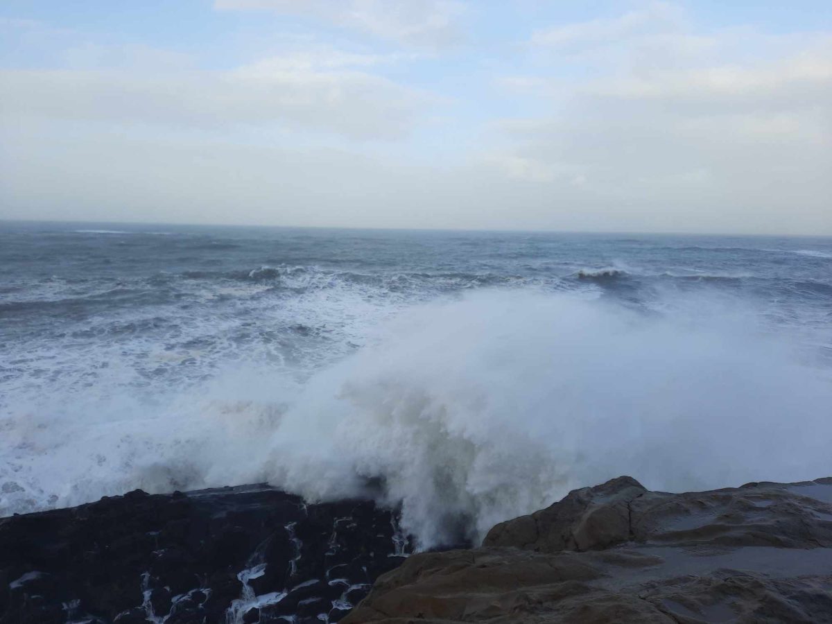
Taking the various stray paths will lead to the ends at different cliff sights and allow for the most unique experiences. Getting close to the edge is not safe as waves will hit the tops of the land up to 30 feet from the edge in many places.
The trail is long and it can get muddy after a lot of rain, but the views are sure to make a splash.
End:
At the very end of the Cape Arago Highway is a round-a-bout road that sends one back to Charleston, but it has more to offer than meets the eye.
The mostly deserted beaches, view of the coastline and one of the closest experiences with seals one can get on the coast make the entire end a cool place to visit, but the lesser known part is the South Cove beach and trails surrounding it.
A marked trail will lead hikers down to the beach, which has a lot of wildlife, rocks to climb and an easily accessible area to wade in the ocean.
On the west end of the beach there are paths to visit tide pools. On the east side of the beach is a steep upward hill, which ends on the highest point at the end of the Cape.
The trails do involve a bit of climbing on rock, but they are fine to climb without gear as the rock is easy to grab and the amount of climbing is minimal.
The destination of the trails give the most expansive view of the coastline, which creates reason to follow them at least once.